Porto Cathedral in Urban History | Maps, Growth, and Geography
See how Porto Cathedral fits into the historic and modern city through map-based narrative and urban reading techniques.
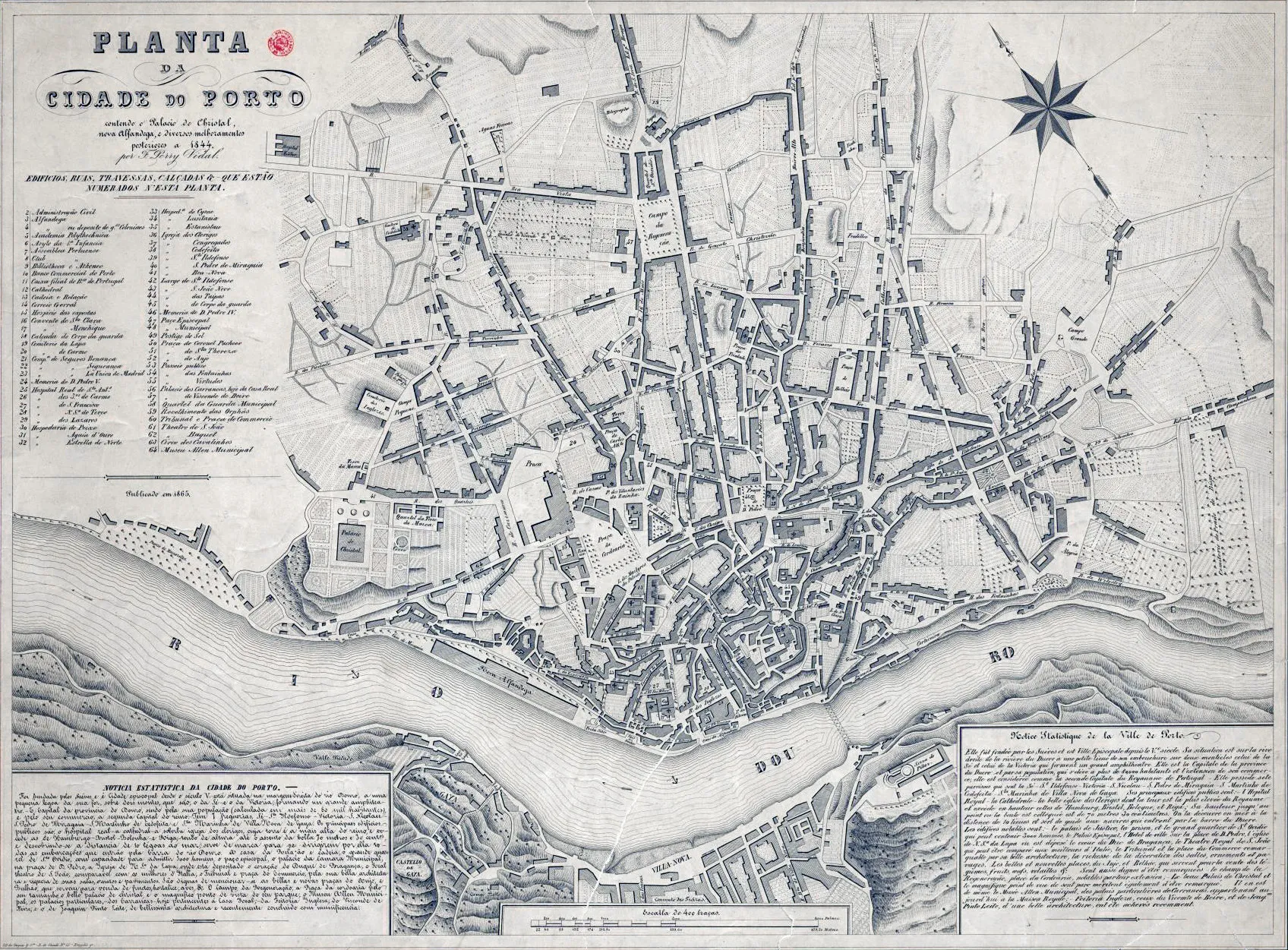
Maps make one thing clear: Porto Cathedral is not randomly placed. Its position reflects strategy, visibility, and governance across centuries.
Reading the city with the cathedral as anchor
- Identify high-ground logic.
- Trace routes toward river trade zones.
- Compare medieval cores with later expansions.
Compact map-reading checklist
- Elevation awareness
- Access corridor logic
- Religious-civic overlap
- Modern tourism pressure points
Geography is the first architecture.
Seeing Sé through maps transforms it from isolated monument into urban key.
Mapping memory
Historic maps do more than locate buildings; they reveal priorities. Street widths, route emphasis, and neighborhood density show what a city considered essential at a given time. In many cartographic frames, Sé appears not as peripheral ornament but as structural reference.
Compare old mapping logic with present pedestrian behavior. Some historic corridors remain legible; others are interrupted by modern flows. The cathedral helps you track both continuity and rupture.
Comparative map prompt
- Mark one historical access route.
- Walk its closest modern equivalent.
- Note what changed in pace, function, and atmosphere.
This method turns map reading into embodied urban history.
著者について

Porto Cathedral Editorial Team
このガイドは、ポルト大聖堂を“短い立ち寄り先”ではなく、背景と文脈をもって味わえる体験として届けるために執筆しました。礼拝堂、石の通路、眺望のひとつひとつが、実感を伴う物語になることを願っています。
Tags
Comments (0)
Loading comments...